
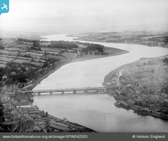
XPW042320 NORTHERN IRELAND (1933). General View, Londonderry, Derry, Northern Ireland, 1933. Oblique aerial photograph taken facing South/West.
© Copyright OpenStreetMap contributors and licensed by the OpenStreetMap Foundation. 2026. Cartography is licensed as CC BY-SA.
Details
| Title | [XPW042320] General View, Londonderry, Derry, Northern Ireland, 1933. Oblique aerial photograph taken facing South/West. |
| Reference | XPW042320 |
| Date | 1933 |
| Link | |
| Place name | LONDONDERRY |
| Parish | NORTHERN IRELAND |
| District | |
| Country | NORTHERN IRELAND |
| Easting / Northing | 59406, 578648 |
| Longitude / Latitude | -7.326469, 54.985558 |
| National Grid Reference |
Pins

SebastianG1 |
Monday 14th of March 2022 11:33:40 PM | |
|
gBr |
Tuesday 23rd of December 2014 10:30:49 PM | |
|
gBr |
Tuesday 23rd of December 2014 10:27:56 PM | |
|
gBr |
Tuesday 23rd of December 2014 10:24:52 PM |