
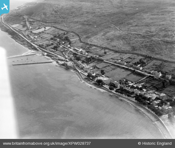
XPW028737 NORTHERN IRELAND (1929). General View, Newcastle, Down, Northern Ireland, 1929. Oblique aerial photograph taken facing South.
© Copyright OpenStreetMap contributors and licensed by the OpenStreetMap Foundation. 2026. Cartography is licensed as CC BY-SA.
Details
| Title | [XPW028737] General View, Newcastle, Down, Northern Ireland, 1929. Oblique aerial photograph taken facing South. |
| Reference | XPW028737 |
| Date | 1929 |
| Link | |
| Place name | NEWCASTLE |
| Parish | NORTHERN IRELAND |
| District | |
| Country | NORTHERN IRELAND |
| Easting / Northing | 146519, 485091 |
| Longitude / Latitude | -5.887851, 54.198737 |
| National Grid Reference |
Pins

CharlesMcR |
Tuesday 13th of June 2017 07:59:52 PM |