
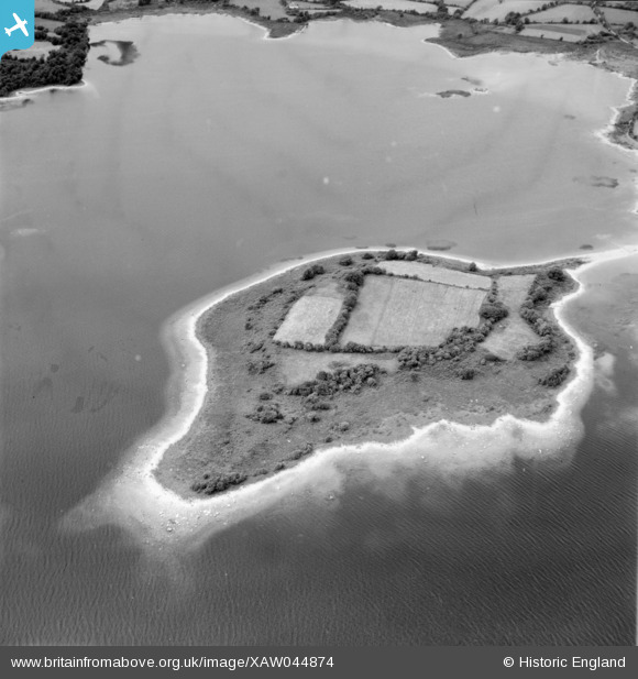
XAW044874 IRELAND (1952). Lough Derg Islands, Lough Derg, Clare, Ireland, 1952. Oblique aerial photograph taken facing North.
© Copyright OpenStreetMap contributors and licensed by the OpenStreetMap Foundation. 2026. Cartography is licensed as CC BY-SA.
Details
| Title | [XAW044874] Lough Derg Islands, Lough Derg, Clare, Ireland, 1952. Oblique aerial photograph taken facing North. |
| Reference | XAW044874 |
| Date | 1952 |
| Link | |
| Place name | LOUGH DERG |
| Parish | IRELAND |
| District | |
| Country | IRELAND |
| Easting / Northing | -30526, 355758 |
| Longitude / Latitude | -8.409158, 52.925971 |
| National Grid Reference |
Pins
Be the first to add a comment to this image!