
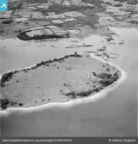
XAW044872 IRELAND (1952). Lough Derg Islands, Lough Derg, Clare, Ireland, 1952. Oblique aerial photograph taken facing North/West.
© Copyright OpenStreetMap contributors and licensed by the OpenStreetMap Foundation. 2026. Cartography is licensed as CC BY-SA.
Details
| Title | [XAW044872] Lough Derg Islands, Lough Derg, Clare, Ireland, 1952. Oblique aerial photograph taken facing North/West. |
| Reference | XAW044872 |
| Date | 1952 |
| Link | |
| Place name | LOUGH DERG |
| Parish | IRELAND |
| District | |
| Country | IRELAND |
| Easting / Northing | -33432, 355043 |
| Longitude / Latitude | -8.451158, 52.917248 |
| National Grid Reference |
Pins
Be the first to add a comment to this image!
User Comment Contributions
Inishcaltra or Holy Island. Once a monastic settlement now uninhabited. Ruins of several churches and a round tower are visible. |

Aidan |
Sunday 9th of November 2014 12:05:30 AM |