
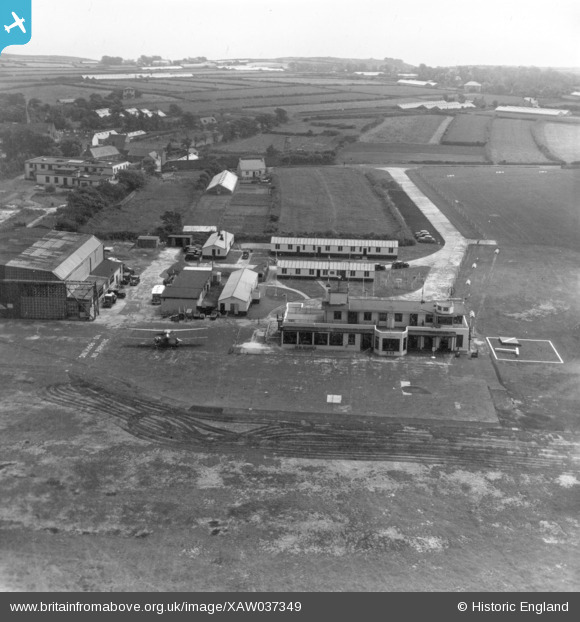
XAW037349 GUERNSEY (1951). Gurnsey Airport, Le Bourg, Guernsey, Guernsey, 1951. Oblique aerial photograph taken facing South.
© Copyright OpenStreetMap contributors and licensed by the OpenStreetMap Foundation. 2025. Cartography is licensed as CC BY-SA.
Details
| Title | [XAW037349] Gurnsey Airport, Le Bourg, Guernsey, Guernsey, 1951. Oblique aerial photograph taken facing South. |
| Reference | XAW037349 |
| Date | 22-June-1951 |
| Link | |
| Place name | LE BOURG |
| Parish | GUERNSEY |
| District | |
| Country | GUERNSEY |
| Easting / Northing | 357002, -51745 |
| Longitude / Latitude | -2.59432, 49.433304 |
| National Grid Reference |
Pins
Be the first to add a comment to this image!