
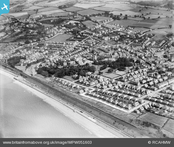
WPW051603 WALES (1936). View of Old Colwyn showing Min-y-Don house and park, oblique aerial view. 5"x4" black and white glass plate negative.
© Copyright OpenStreetMap contributors and licensed by the OpenStreetMap Foundation. 2026. Cartography is licensed as CC BY-SA.
Details
| Title | [WPW051603] View of Old Colwyn showing Min-y-Don house and park, oblique aerial view. 5"x4" black and white glass plate negative. |
| Reference | WPW051603 |
| Date | 1936 |
| Link | Coflein Archive Item 6370006 |
| Place name | |
| Parish | |
| District | |
| Country | WALES |
| Easting / Northing | 286800, 378570 |
| Longitude / Latitude | -3.6984762755926, 53.291710790746 |
| National Grid Reference | SH868786 |
Pins

seasidemike |
Wednesday 26th of November 2014 05:13:47 PM | |
|
colwynboy |
Tuesday 28th of August 2012 10:32:35 AM | |
|
longshot |
Saturday 4th of August 2012 05:09:34 PM |