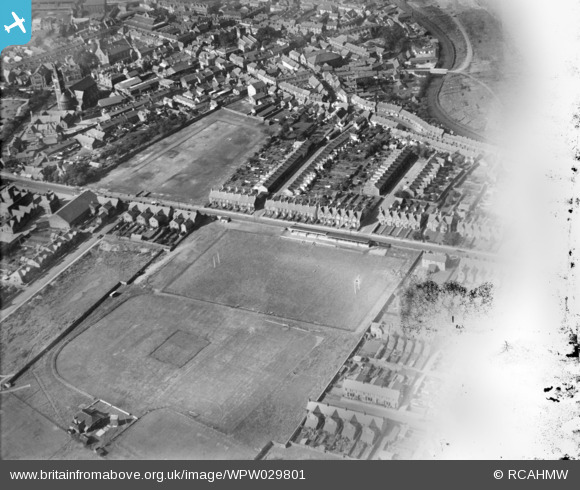
WPW029801 WALES (1929). View of the Gnoll rugby and cricket grounds, Neath, oblique aerial view. 5"x4" black and white glass plate negative.
© Copyright OpenStreetMap contributors and licensed by the OpenStreetMap Foundation. 2025. Cartography is licensed as CC BY-SA.
Details
| Title | [WPW029801] View of the Gnoll rugby and cricket grounds, Neath, oblique aerial view. 5"x4" black and white glass plate negative. |
| Reference | WPW029801 |
| Date | 1929 |
| Link | Coflein Archive Item 6370650 |
| Place name | |
| Parish | |
| District | |
| Country | WALES |
| Easting / Northing | 275820, 197570 |
| Longitude / Latitude | -3.7956490665516, 51.662707752018 |
| National Grid Reference | SS758976 |
Pins
 edwardske |
Tuesday 1st of March 2022 08:53:32 AM | |
 Class31 |
Monday 28th of October 2013 01:43:26 PM | |
 Class31 |
Monday 28th of October 2013 01:41:55 PM | |
 Class31 |
Monday 28th of October 2013 01:40:02 PM | |
 Class31 |
Monday 28th of October 2013 01:38:28 PM | |
 Class31 |
Monday 28th of October 2013 01:36:57 PM | |
 Class31 |
Saturday 20th of April 2013 10:36:33 PM | |
 Class31 |
Saturday 20th of April 2013 10:36:06 PM | |
 Class31 |
Saturday 20th of April 2013 10:33:36 PM | |
 Class31 |
Saturday 20th of April 2013 10:33:09 PM | |
 Class31 |
Saturday 20th of April 2013 10:32:31 PM |

