
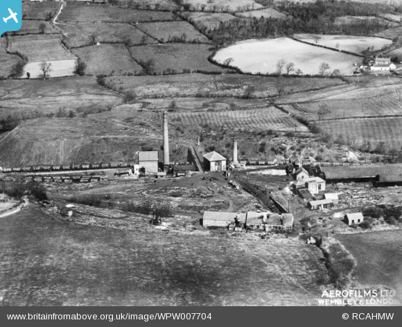
WPW007704 WALES (1922). View of Pontyberem Slants Colliery with the old coal levels in the distance at Maes-mawr. Oblique aerial photograph, 5"x4" BW glass plate.
© Copyright OpenStreetMap contributors and licensed by the OpenStreetMap Foundation. 2025. Cartography is licensed as CC BY-SA.
Details
| Title | [WPW007704] View of Pontyberem Slants Colliery with the old coal levels in the distance at Maes-mawr. Oblique aerial photograph, 5"x4" BW glass plate. |
| Reference | WPW007704 |
| Date | April-1922 |
| Link | Coflein Archive Item 6423210 |
| Place name | |
| Parish | |
| District | |
| Country | WALES |
| Easting / Northing | 249900, 211270 |
| Longitude / Latitude | -4.1760925133794, 51.779486178457 |
| National Grid Reference | SN499113 |
Pins
Be the first to add a comment to this image!