
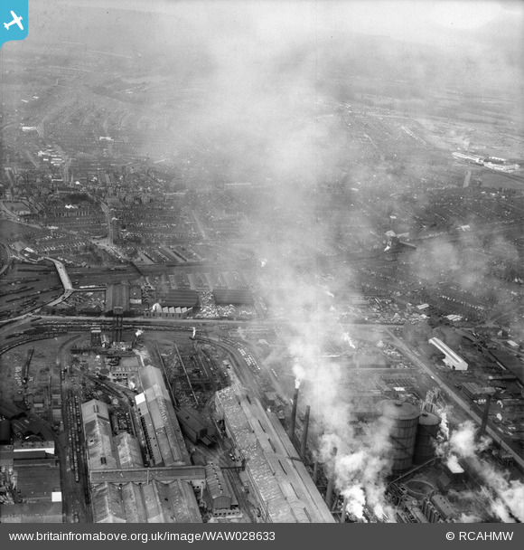
WAW028633 WALES (1950). View of Cardiff showing Roath area and power station
© Copyright OpenStreetMap contributors and licensed by the OpenStreetMap Foundation. 2026. Cartography is licensed as CC BY-SA.
Nearby Images (48)
WPW001000

WPW001001

WPW001002

WPW001003

WPW001004

WPW001008

WPW001009

WPW001010

WPW001014

WPW001035

WPW016914

WPW016915

WPW016916

WPW016917

WPW016918

WPW016919

WPW016920

WPW029422

WPW029423

WPW029424

WPW029425

WPW029427

WPW029429

WPW041787

WPW041788

WPW041789

WPW041790

WPW041791

WPW041792

WPW041793

WPW041794

WPW041795

WPW052624

WPW052659

WPW052660

WPW052661

WPW052662

WPW052663

WPW052664

WPW054861

WPW054863

WPW054864

WPW054865

WPW055450

WPW055451

WPW055452

WPW055453

WPW055454

Details
| Title | [WAW028633] View of Cardiff showing Roath area and power station |
| Reference | WAW028633 |
| Date | 6-April-1950 |
| Link | Coflein Archive Item 6414185 |
| Place name | |
| Parish | |
| District | |
| Country | WALES |
| Easting / Northing | 318170, 176360 |
| Longitude / Latitude | -3.1785006478589, 51.479784917149 |
| National Grid Reference | ST182764 |
Pins

redmist |
Monday 23rd of November 2020 04:40:16 PM | |

Class31 |
Tuesday 29th of July 2014 05:00:00 PM | |
|
Class31 |
Tuesday 29th of July 2014 04:55:57 PM | |
|
Class31 |
Tuesday 29th of July 2014 04:55:37 PM | |
|
Class31 |
Tuesday 29th of July 2014 04:55:14 PM |
User Comment Contributions
This has been completely misidentified as Roath Power Station. It is in fact East Moors Steelworks looking north. |
Class31 |
Tuesday 29th of July 2014 04:57:29 PM |