
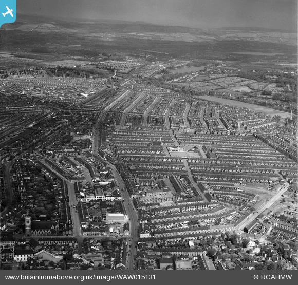
WAW015131 WALES (1948). General view of Cardiff showing the Roath area
© Copyright OpenStreetMap contributors and licensed by the OpenStreetMap Foundation. 2026. Cartography is licensed as CC BY-SA.
Nearby Images (48)
WPW001000

WPW001001

WPW001002

WPW001003

WPW001004

WPW001008

WPW001009

WPW001010

WPW001014

WPW001035

WPW016914

WPW016915

WPW016916

WPW016917

WPW016918

WPW016919

WPW016920

WPW029422

WPW029423

WPW029424

WPW029425

WPW029427

WPW029429

WPW041787

WPW041788

WPW041789

WPW041790

WPW041791

WPW041792

WPW041793

WPW041794

WPW041795

WPW052624

WPW052659

WPW052660

WPW052661

WPW052662

WPW052663

WPW052664

WPW054861

WPW054863

WPW054864

WPW054865

WPW055450

WPW055451

WPW055452

WPW055453

WPW055454

Details
| Title | [WAW015131] General view of Cardiff showing the Roath area |
| Reference | WAW015131 |
| Date | 29-April-1948 |
| Link | Coflein Archive Item 6413919 |
| Place name | |
| Parish | |
| District | |
| Country | WALES |
| Easting / Northing | 318170, 176360 |
| Longitude / Latitude | -3.1785006478589, 51.479784917149 |
| National Grid Reference | ST182764 |
Pins

Topsin |
Saturday 28th of March 2026 07:25:15 PM | |
|
Topsin |
Saturday 28th of March 2026 07:24:29 PM | |
|
Neil Trickett |
Monday 2nd of June 2025 01:02:04 PM | |
|
Neil Trickett |
Monday 2nd of June 2025 11:29:27 AM | |
|
hjr |
Thursday 29th of May 2014 02:10:49 AM | |
|
Debs. |
Friday 9th of May 2014 11:02:36 PM | |
|
Chelsea61 |
Friday 25th of April 2014 06:29:19 PM |