
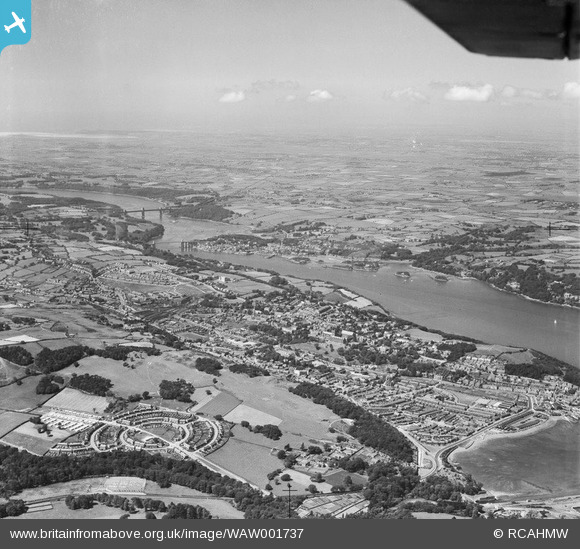
WAW001737 WALES (1946). Distant view of Bangor and Menai Straits showing Maesgeirchen housing estate
© Copyright OpenStreetMap contributors and licensed by the OpenStreetMap Foundation. 2026. Cartography is licensed as CC BY-SA.
Details
| Title | [WAW001737] Distant view of Bangor and Menai Straits showing Maesgeirchen housing estate |
| Reference | WAW001737 |
| Date | 11-July-1946 |
| Link | Coflein Archive Item 6413196 |
| Place name | |
| Parish | |
| District | |
| Country | WALES |
| Easting / Northing | 258900, 371820 |
| Longitude / Latitude | -4.1138188059267, 53.224377557361 |
| National Grid Reference | SH589718 |
Pins

sirdouglas |
Tuesday 27th of September 2016 07:35:03 PM | |
|
sirdouglas |
Tuesday 9th of August 2016 12:02:05 PM | |

Wyn |
Wednesday 6th of August 2014 11:49:04 AM | |
|
Wyn |
Tuesday 5th of August 2014 12:28:02 PM |