
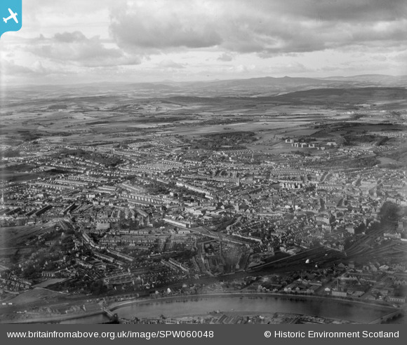
SPW060048 SCOTLAND (1938). Aberdeen, general view, showing Aberdeen Station and Royal Infirmary, Foresterhill Road. An oblique aerial photograph taken facing north-west.
© Copyright OpenStreetMap contributors and licensed by the OpenStreetMap Foundation. 2025. Cartography is licensed as CC BY-SA.
Details
| Title | [SPW060048] Aberdeen, general view, showing Aberdeen Station and Royal Infirmary, Foresterhill Road. An oblique aerial photograph taken facing north-west. |
| Reference | SPW060048 |
| Date | 1938 |
| Link | NRHE Collection item 1258286 |
| Place name | |
| Parish | ABERDEEN |
| District | CITY OF ABERDEEN |
| Country | SCOTLAND |
| Easting / Northing | 392079, 806349 |
| Longitude / Latitude | -2.1309247683308, 57.148141854678 |
| National Grid Reference | NJ921063 |
Pins

toonserjim |
Monday 6th of October 2014 09:38:16 PM | |
|
toonserjim |
Wednesday 12th of February 2014 08:12:59 PM | |
|
toonserjim |
Wednesday 12th of February 2014 08:12:19 PM | |
|
toonserjim |
Wednesday 12th of February 2014 08:11:22 PM |