
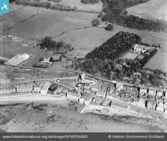
SPW056893 SCOTLAND (1938). Fairlie, general view, showing St Paul's Parish Church, Main Road and Craig Hill. An oblique aerial photograph taken facing east.
© Copyright OpenStreetMap contributors and licensed by the OpenStreetMap Foundation. 2026. Cartography is licensed as CC BY-SA.
Details
| Title | [SPW056893] Fairlie, general view, showing St Paul's Parish Church, Main Road and Craig Hill. An oblique aerial photograph taken facing east. |
| Reference | SPW056893 |
| Date | 1938 |
| Link | NRHE Collection item 1258244 |
| Place name | |
| Parish | LARGS |
| District | CUNNINGHAME |
| Country | SCOTLAND |
| Easting / Northing | 221000, 655623 |
| Longitude / Latitude | -4.8531862579677, 55.760807344869 |
| National Grid Reference | NS210556 |
Pins

Peggy Bawn |
Wednesday 30th of April 2014 09:00:39 AM | |
|
thomasmann |
Monday 27th of August 2012 02:19:54 PM | |
Only a small bronze model of a racing yacht with information plaques now mark what was the site of Fife's boatyard. |
braeside |
Monday 27th of August 2012 07:32:44 PM |
|
thomasmann |
Monday 27th of August 2012 02:19:25 PM | |
|
thomasmann |
Monday 27th of August 2012 02:18:53 PM | |
|
thomasmann |
Monday 27th of August 2012 02:18:22 PM | |
|
thomasmann |
Monday 27th of August 2012 02:17:56 PM | |
|
thomasmann |
Monday 27th of August 2012 02:17:23 PM | |
|
thomasmann |
Monday 27th of August 2012 02:16:53 PM |