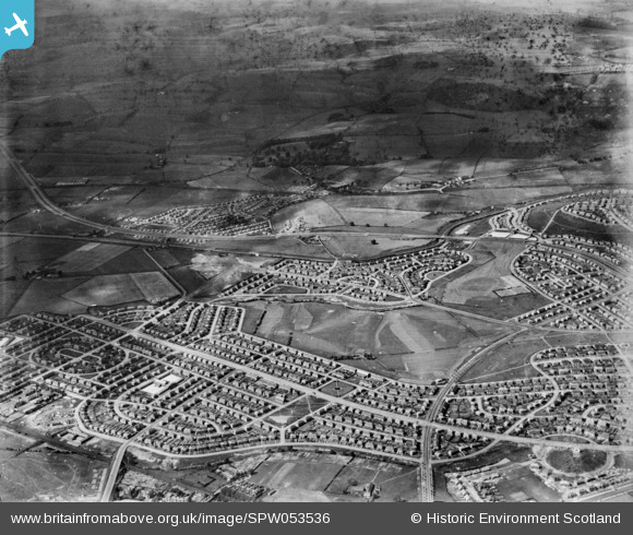
SPW053536 SCOTLAND (1937). General view, Knightswood, New Kilpatrick, Dunbartonshire, Scotland, 1937. An oblique aerial photograph, taken facing north.
© Copyright OpenStreetMap contributors and licensed by the OpenStreetMap Foundation. 2026. Cartography is licensed as CC BY-SA.
Details
| Title | [SPW053536] General view, Knightswood, New Kilpatrick, Dunbartonshire, Scotland, 1937. An oblique aerial photograph, taken facing north. |
| Reference | SPW053536 |
| Date | 1937 |
| Link | NRHE Collection item 1452160 |
| Place name | |
| Parish | RENFREW (CITY OF GLASGOW) |
| District | CITY OF GLASGOW |
| Country | SCOTLAND |
| Easting / Northing | 252570, 669780 |
| Longitude / Latitude | -4.3581831957733, 55.898561635726 |
| National Grid Reference | NS526698 |
Pins

Kieran Goddard |
Saturday 6th of March 2021 09:56:40 PM | |

john divers |
Friday 11th of May 2018 12:15:49 PM | |

Donald Marshall |
Tuesday 11th of November 2014 03:13:37 PM | |

Donald Marshall |
Tuesday 11th of November 2014 03:12:39 PM | |

Donald Marshall |
Tuesday 11th of November 2014 03:11:37 PM | |

Donald Marshall |
Tuesday 11th of November 2014 03:10:41 PM | |

Donald Marshall |
Tuesday 11th of November 2014 03:05:31 PM |


