
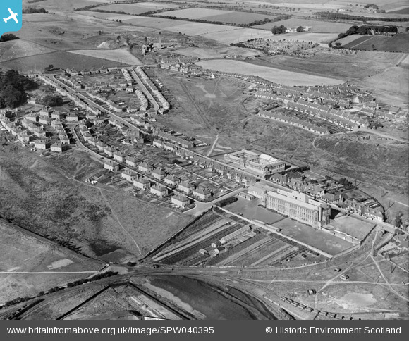
SPW040395 SCOTLAND (1932). Cowdenbeath, general view, showing Beath Higher Grade School and Stenhouse Street. An oblique aerial photograph taken facing north-west.
© Copyright OpenStreetMap contributors and licensed by the OpenStreetMap Foundation. 2026. Cartography is licensed as CC BY-SA.
Details
| Title | [SPW040395] Cowdenbeath, general view, showing Beath Higher Grade School and Stenhouse Street. An oblique aerial photograph taken facing north-west. |
| Reference | SPW040395 |
| Date | 1932 |
| Link | NRHE Collection item 1257462 |
| Place name | |
| Parish | BEATH |
| District | DUNFERMLINE |
| Country | SCOTLAND |
| Easting / Northing | 315900, 691630 |
| Longitude / Latitude | -3.3524765504612, 56.110075348355 |
| National Grid Reference | NT159916 |
Pins

Canonach |
Friday 5th of September 2014 08:34:14 PM | |
Chalmers Japp was my grandfather - I'd love to know why this is tagged |
McGinty |
Monday 7th of March 2016 03:53:51 PM |
|
Canonach |
Friday 5th of September 2014 08:29:37 PM | |
|
Canonach |
Friday 5th of September 2014 08:26:15 PM | |
|
Canonach |
Friday 5th of September 2014 08:25:22 PM | |
|
Andy A |
Thursday 2nd of January 2014 08:45:28 PM | |
|
Andy A |
Thursday 2nd of January 2014 08:44:52 PM |