
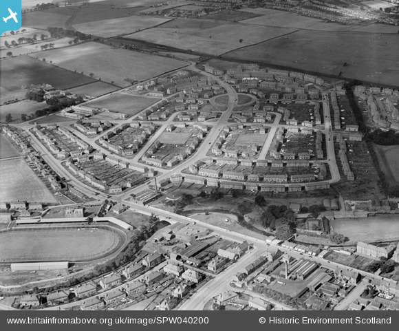
SPW040200 SCOTLAND (1932). Stenhouse Housing Estate, Edinburgh. An oblique aerial photograph taken facing north-west.
© Copyright OpenStreetMap contributors and licensed by the OpenStreetMap Foundation. 2026. Cartography is licensed as CC BY-SA.
Details
| Title | [SPW040200] Stenhouse Housing Estate, Edinburgh. An oblique aerial photograph taken facing north-west. |
| Reference | SPW040200 |
| Date | 1932 |
| Link | NRHE Collection item 1257288 |
| Place name | |
| Parish | EDINBURGH (EDINBURGH, CITY OF) |
| District | CITY OF EDINBURGH |
| Country | SCOTLAND |
| Easting / Northing | 321280, 671720 |
| Longitude / Latitude | -3.2601421455845, 55.932130140377 |
| National Grid Reference | NT213717 |
Pins

Pussers Hard |
Saturday 8th of February 2025 12:39:06 PM | |
|
Pussers Hard |
Saturday 8th of February 2025 12:22:42 PM | |
|
Pussers Hard |
Saturday 8th of February 2025 12:21:48 PM | |
|
kipacala |
Wednesday 4th of February 2015 02:00:02 PM | |
|
kipacala |
Wednesday 4th of February 2015 01:58:10 PM | |
|
Andy A |
Monday 21st of April 2014 12:28:33 AM | |
|
Andy A |
Monday 21st of April 2014 12:27:11 AM | |
|
Andy A |
Monday 21st of April 2014 12:26:42 AM | |
|
Andy A |
Monday 21st of April 2014 12:26:19 AM | |
|
Andy A |
Monday 21st of April 2014 12:26:03 AM | |
Opened for Greyhounds 1932 but had been a footie ground for some time before, Civil Service Strollers using it from 1908 into the 1920s. Also used for trotting, show jumping etc. |
gBr |
Thursday 28th of January 2016 11:46:22 PM |
|
Andy A |
Monday 21st of April 2014 12:22:15 AM |