
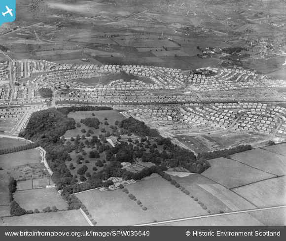
SPW035649 SCOTLAND (1931). King's Park and Croftfoot Housing Estates and King's Park, Glasgow. An oblique aerial photograph taken facing north.
© Copyright OpenStreetMap contributors and licensed by the OpenStreetMap Foundation. 2025. Cartography is licensed as CC BY-SA.
Details
| Title | [SPW035649] King's Park and Croftfoot Housing Estates and King's Park, Glasgow. An oblique aerial photograph taken facing north. |
| Reference | SPW035649 |
| Date | 1931 |
| Link | Canmore Collection item 1259437 |
| Place name | |
| Parish | CATHCART (CITY OF GLASGOW) |
| District | CITY OF GLASGOW |
| Country | SCOTLAND |
| Easting / Northing | 259750, 660750 |
| Longitude / Latitude | -4.2387688943226, 55.819625399485 |
| National Grid Reference | NS598608 |
Pins
Be the first to add a comment to this image!