
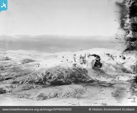
SPW025620 SCOTLAND (1929). Leadhills, general view, showing Wool Law and Louise Wood Law. An oblique aerial photograph taken facing east. This image has been produced from a damaged negative.
© Copyright OpenStreetMap contributors and licensed by the OpenStreetMap Foundation. 2025. Cartography is licensed as CC BY-SA.
Details
| Title | [SPW025620] Leadhills, general view, showing Wool Law and Louise Wood Law. An oblique aerial photograph taken facing east. This image has been produced from a damaged negative. |
| Reference | SPW025620 |
| Date | 1929 |
| Link | NRHE Collection item 1259331 |
| Place name | |
| Parish | CRAWFORD |
| District | CLYDESDALE |
| Country | SCOTLAND |
| Easting / Northing | 288700, 616500 |
| Longitude / Latitude | -3.7590326837191, 55.429711996519 |
| National Grid Reference | NS887165 |
Pins
Be the first to add a comment to this image!
User Comment Contributions
Very difficult to make sense of this one at this time. I have twice marked Roan Burn but lacked conviction to leave in. Perhaps we have someone to help? I seem to remember a sitcom called Hope Springs which featured this area. |

Class31 |
Monday 22nd of October 2012 11:05:09 AM |