
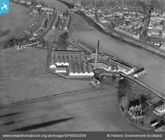
SPW020306 SCOTLAND (1928). Keirfield Bleaching and Dyeing Mill, Bridge of Allan. An oblique aerial photograph taken facing north.
© Copyright OpenStreetMap contributors and licensed by the OpenStreetMap Foundation. 2025. Cartography is licensed as CC BY-SA.
Details
| Title | [SPW020306] Keirfield Bleaching and Dyeing Mill, Bridge of Allan. An oblique aerial photograph taken facing north. |
| Reference | SPW020306 |
| Date | 1928 |
| Link | Canmore Collection item 1256207 |
| Place name | |
| Parish | LOGIE (STIRLING) |
| District | STIRLING |
| Country | SCOTLAND |
| Easting / Northing | 278843, 697249 |
| Longitude / Latitude | -3.950643070316, 56.152575979186 |
| National Grid Reference | NS788972 |
Pins
 Xabier Cid |
Monday 9th of July 2012 12:22:53 AM | |
Xabier Cid |
Monday 9th of July 2012 12:22:33 AM | |
Xabier Cid |
Monday 9th of July 2012 12:21:58 AM |
User Comment Contributions
Old Bridge of Allan, replaced 1957-60. |
Stirlingjohn |
Wednesday 2nd of January 2013 02:15:55 PM |