
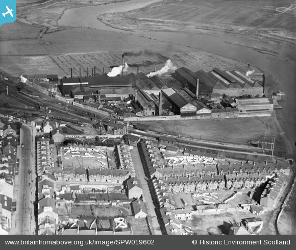
SPW019602 SCOTLAND (1927). Dumbarton, general view, showing Dalreoch Station and Hardie and Cordon Levenbank Foundry. An oblique aerial photograph taken facing north.
© Copyright OpenStreetMap contributors and licensed by the OpenStreetMap Foundation. 2026. Cartography is licensed as CC BY-SA.
Details
| Title | [SPW019602] Dumbarton, general view, showing Dalreoch Station and Hardie and Cordon Levenbank Foundry. An oblique aerial photograph taken facing north. |
| Reference | SPW019602 |
| Date | 1927 |
| Link | NRHE Collection item 1256164 |
| Place name | |
| Parish | CARDROSS (WEST DUMBARTONSHIRE) |
| District | DUMBARTON |
| Country | SCOTLAND |
| Easting / Northing | 239117, 675706 |
| Longitude / Latitude | -4.5766626106029, 55.947451790657 |
| National Grid Reference | NS391757 |
Pins

Billy Turner |
Thursday 13th of September 2018 07:43:08 PM | |

John Wass |
Sunday 23rd of August 2015 07:57:09 PM | |
|
John Wass |
Sunday 23rd of August 2015 07:56:04 PM | |
|
John Wass |
Sunday 23rd of August 2015 07:55:31 PM | |
|
John Wass |
Sunday 23rd of August 2015 07:54:10 PM | |
|
John Wass |
Sunday 23rd of August 2015 07:53:04 PM | |
|
John Wass |
Sunday 23rd of August 2015 07:53:00 PM |