
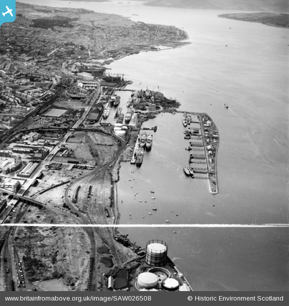
SAW026508 SCOTLAND (1949). Greenock Harbour. An oblique aerial photograph taken facing north-west. This image has been produced from a crop marked negative.
© Copyright OpenStreetMap contributors and licensed by the OpenStreetMap Foundation. 2026. Cartography is licensed as CC BY-SA.
Details
| Title | [SAW026508] Greenock Harbour. An oblique aerial photograph taken facing north-west. This image has been produced from a crop marked negative. |
| Reference | SAW026508 |
| Date | 1949 |
| Link | NRHE Collection item 1269357 |
| Place name | |
| Parish | GREENOCK |
| District | INVERCLYDE |
| Country | SCOTLAND |
| Easting / Northing | 230304, 675600 |
| Longitude / Latitude | -4.717568867943, 55.943470095926 |
| National Grid Reference | NS303756 |
Pins

Tam |
Tuesday 12th of April 2022 03:16:26 PM | |
|
yes |
Saturday 27th of February 2021 07:50:17 PM | |

navaho56 |
Monday 3rd of June 2019 09:52:51 AM | |
|
Weechookieburdie |
Monday 3rd of June 2019 09:36:36 AM | |
|
Weechookieburdie |
Monday 3rd of June 2019 09:32:56 AM | |
|
The Local Historian |
Thursday 2nd of May 2019 07:44:35 PM | |
|
Andy A |
Sunday 8th of April 2018 01:33:13 AM |
