
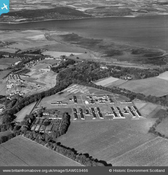
SAW019466 SCOTLAND (1948). General view, Inverness, Inverness-shire, Scotland, 1948. An oblique Aerial photograph taken facing north.
© Copyright OpenStreetMap contributors and licensed by the OpenStreetMap Foundation. 2026. Cartography is licensed as CC BY-SA.
Details
| Title | [SAW019466] General view, Inverness, Inverness-shire, Scotland, 1948. An oblique Aerial photograph taken facing north. |
| Reference | SAW019466 |
| Date | 1948 |
| Link | NRHE Collection item 1451830 |
| Place name | |
| Parish | INVERNESS AND BONA |
| District | INVERNESS |
| Country | SCOTLAND |
| Easting / Northing | 268636, 844813 |
| Longitude / Latitude | -4.1908511290173, 57.474737071959 |
| National Grid Reference | NH686448 |
