
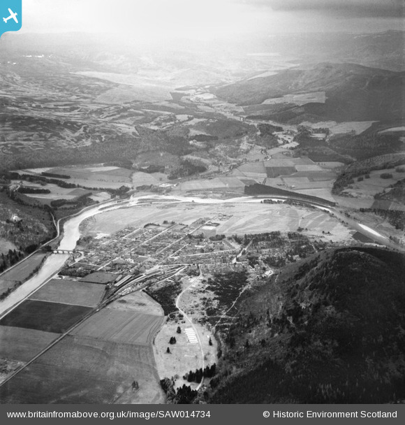
SAW014734 SCOTLAND (1948). Ballater, general view, showing Royal Bridge and Craigendarroch. An oblique aerial photograph taken facing south.
© Copyright OpenStreetMap contributors and licensed by the OpenStreetMap Foundation. 2025. Cartography is licensed as CC BY-SA.
Details
| Title | [SAW014734] Ballater, general view, showing Royal Bridge and Craigendarroch. An oblique aerial photograph taken facing south. |
| Reference | SAW014734 |
| Date | 1948 |
| Link | NRHE Collection item 1268860 |
| Place name | |
| Parish | GLENMUICK, TULLICH AND GLENGAIRN |
| District | KINCARDINE AND DEESIDE |
| Country | SCOTLAND |
| Easting / Northing | 336347, 795434 |
| Longitude / Latitude | -3.0492362436713, 57.045754159971 |
| National Grid Reference | NO363954 |
Pins
Be the first to add a comment to this image!