
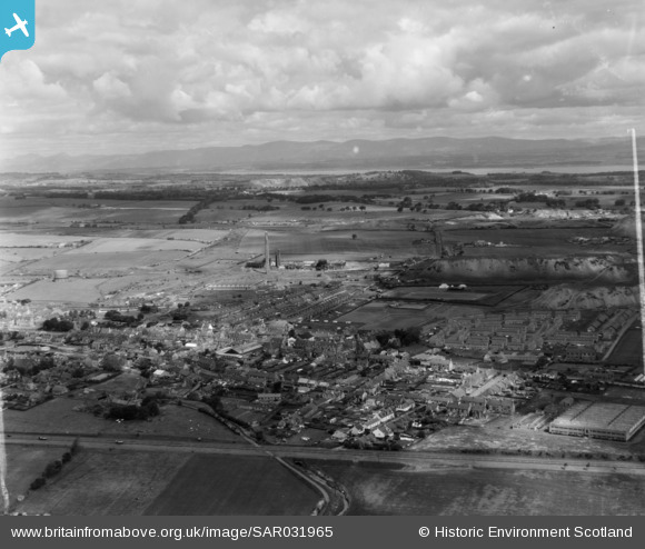
SAR031965 SCOTLAND (1958). Broxburn Uphall, West Lothian, Scotland. An oblique aerial photograph taken facing North/West.
© Copyright OpenStreetMap contributors and licensed by the OpenStreetMap Foundation. 2026. Cartography is licensed as CC BY-SA.
Details
| Title | [SAR031965] Broxburn Uphall, West Lothian, Scotland. An oblique aerial photograph taken facing North/West. |
| Reference | SAR031965 |
| Date | 1958 |
| Link | NRHE Collection item 1438581 |
| Place name | |
| Parish | UPHALL |
| District | WEST LOTHIAN |
| Country | SCOTLAND |
| Easting / Northing | 308636, 672077 |
| Longitude / Latitude | -3.4625978791783, 55.933101109953 |
| National Grid Reference | NT086721 |
Pins

Mark Gee |
Saturday 11th of September 2021 08:22:06 PM | |
|
heather |
Friday 19th of February 2021 05:53:52 PM | |

KeithR |
Wednesday 31st of May 2017 03:32:34 PM | |
|
KeithR |
Thursday 3rd of November 2016 09:54:08 AM |