
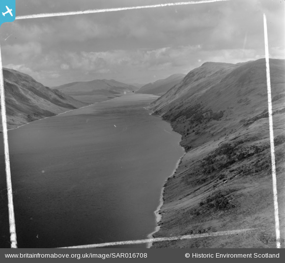
SAR016708 SCOTLAND (1952). Loch Ericht, showing Aonaich Mhoir from over Rubha ban Mor Fortingall, Perthshire, Scotland. An oblique aerial photograph taken facing North/East. This image was marked by AeroPictorial Ltd for photo editing.
© Copyright OpenStreetMap contributors and licensed by the OpenStreetMap Foundation. 2026. Cartography is licensed as CC BY-SA.
Details
| Title | [SAR016708] Loch Ericht, showing Aonaich Mhoir from over Rubha ban Mor Fortingall, Perthshire, Scotland. An oblique aerial photograph taken facing North/East. This image was marked by AeroPictorial Ltd for photo editing. |
| Reference | SAR016708 |
| Date | 1952 |
| Link | NRHE Collection item 1437967 |
| Place name | |
| Parish | FORTINGALL |
| District | PERTH AND KINROSS |
| Country | SCOTLAND |
| Easting / Northing | 253930, 766930 |
| Longitude / Latitude | -4.3903869373897, 56.771151182446 |
| National Grid Reference | NN539669 |
Pins
Nadia Test |
Tuesday 12th of May 2026 02:23:58 PM | |
Test Nadia Reply |
Nadia Test |
Tuesday 12th of May 2026 02:25:05 PM |
