
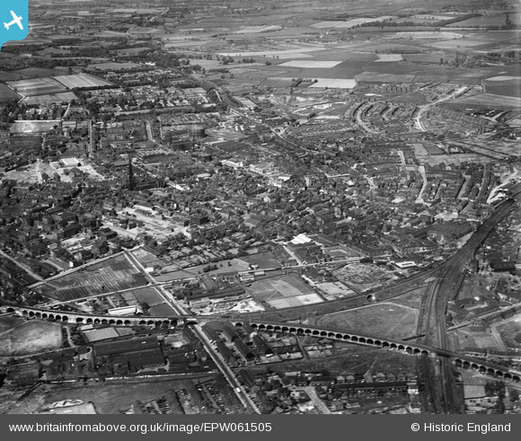
EPW061505 ENGLAND (1939). The city centre, Wakefield, from the south-west, 1939
© Copyright OpenStreetMap contributors and licensed by the OpenStreetMap Foundation. 2026. Cartography is licensed as CC BY-SA.
Details
| Title | [EPW061505] The city centre, Wakefield, from the south-west, 1939 |
| Reference | EPW061505 |
| Date | 2-June-1939 |
| Link | |
| Place name | WAKEFIELD |
| Parish | |
| District | |
| Country | ENGLAND |
| Easting / Northing | 433227, 420236 |
| Longitude / Latitude | -1.4969327493109, 53.677303577015 |
| National Grid Reference | SE332202 |
Pins

DAVE |
Friday 18th of July 2025 02:40:37 PM | |

Matt Aldred edob.mattaldred.com |
Monday 11th of March 2024 05:35:51 PM |