
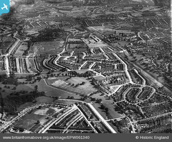
EPW061340 ENGLAND (1939). Oakhill Park and Brunswick Park, East Barnet, from the north-west, 1939
© Copyright OpenStreetMap contributors and licensed by the OpenStreetMap Foundation. 2026. Cartography is licensed as CC BY-SA.
Details
| Title | [EPW061340] Oakhill Park and Brunswick Park, East Barnet, from the north-west, 1939 |
| Reference | EPW061340 |
| Date | 2-June-1939 |
| Link | |
| Place name | EAST BARNET |
| Parish | |
| District | |
| Country | ENGLAND |
| Easting / Northing | 527610, 194970 |
| Longitude / Latitude | -0.15572914378902, 51.63857142952 |
| National Grid Reference | TQ276950 |
Pins

mearle |
Wednesday 29th of June 2022 01:50:26 PM | |
|
robert |
Wednesday 23rd of December 2020 07:21:16 PM | |
|
robert |
Wednesday 23rd of December 2020 07:20:52 PM | |
|
robert |
Wednesday 23rd of December 2020 07:20:22 PM | |
|
JM |
Thursday 6th of August 2015 10:20:34 AM | |
|
Brian D |
Friday 30th of January 2015 08:22:38 PM | |
|
Brian D |
Friday 30th of January 2015 08:21:55 PM |