
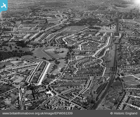
EPW061339 ENGLAND (1939). Oakhill Park and Brunswick Park, East Barnet, from the north-west, 1939
© Copyright OpenStreetMap contributors and licensed by the OpenStreetMap Foundation. 2025. Cartography is licensed as CC BY-SA.
Details
| Title | [EPW061339] Oakhill Park and Brunswick Park, East Barnet, from the north-west, 1939 |
| Reference | EPW061339 |
| Date | 2-June-1939 |
| Link | |
| Place name | EAST BARNET |
| Parish | |
| District | |
| Country | ENGLAND |
| Easting / Northing | 527206, 195160 |
| Longitude / Latitude | -0.16149559477052, 51.640370616149 |
| National Grid Reference | TQ272952 |
Pins
 Doris |
Wednesday 16th of November 2016 05:49:10 AM | |
JM |
Thursday 6th of August 2015 10:19:11 AM | |
Brian D |
Friday 30th of January 2015 08:34:15 PM | |
Brian D |
Friday 30th of January 2015 08:32:12 PM | |
Chris |
Thursday 27th of March 2014 06:13:09 PM |