
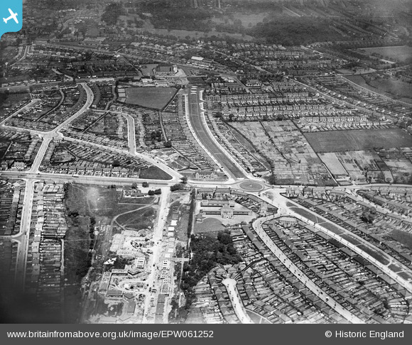
EPW061252 ENGLAND (1939). Housing surrounding Ridgacre Road and Wolverhampton Road South, Ridgacre, 1939
© Copyright OpenStreetMap contributors and licensed by the OpenStreetMap Foundation. 2026. Cartography is licensed as CC BY-SA.
Details
| Title | [EPW061252] Housing surrounding Ridgacre Road and Wolverhampton Road South, Ridgacre, 1939 |
| Reference | EPW061252 |
| Date | 31-May-1939 |
| Link | |
| Place name | RIDGACRE |
| Parish | |
| District | |
| Country | ENGLAND |
| Easting / Northing | 401185, 284808 |
| Longitude / Latitude | -1.9825573238588, 52.460845750067 |
| National Grid Reference | SP012848 |
Pins

Steve Cemm |
Wednesday 3rd of August 2016 08:23:03 PM | |
|
Steve Cemm |
Wednesday 3rd of August 2016 08:08:39 PM | |
|
Steve Cemm |
Wednesday 3rd of August 2016 08:07:23 PM | |
|
Steve Cemm |
Wednesday 3rd of August 2016 08:06:36 PM | |
|
Griffin |
Tuesday 3rd of November 2015 09:50:16 PM | |
|
Griffin |
Tuesday 3rd of November 2015 09:47:35 PM | |
|
Griffin |
Tuesday 3rd of November 2015 09:42:43 PM | |
|
Griffin |
Tuesday 3rd of November 2015 09:41:27 PM | |
|
Griffin |
Tuesday 3rd of November 2015 09:39:18 PM |