
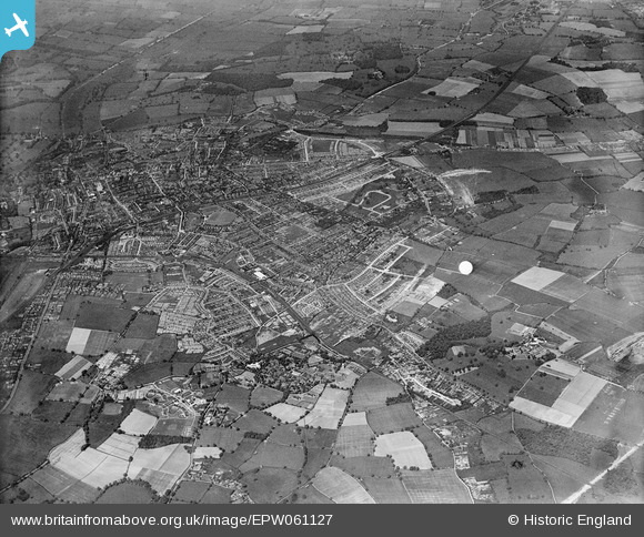
EPW061127 ENGLAND (1939). The city, St Albans, from the south-east, 1939
© Copyright OpenStreetMap contributors and licensed by the OpenStreetMap Foundation. 2026. Cartography is licensed as CC BY-SA.
Details
| Title | [EPW061127] The city, St Albans, from the south-east, 1939 |
| Reference | EPW061127 |
| Date | 30-May-1939 |
| Link | |
| Place name | ST ALBANS |
| Parish | |
| District | |
| Country | ENGLAND |
| Easting / Northing | 517027, 207279 |
| Longitude / Latitude | -0.30447330434882, 51.751510148164 |
| National Grid Reference | TL170073 |
Pins

Textureman |
Monday 24th of July 2023 03:31:05 PM | |
|
Textureman |
Monday 24th of July 2023 03:29:20 PM | |
|
Textureman |
Thursday 20th of August 2020 08:00:37 PM | |
|
Textureman |
Thursday 20th of August 2020 07:59:11 PM | |
|
Textureman |
Thursday 20th of August 2020 07:58:19 PM | |
|
Textureman |
Thursday 20th of August 2020 07:56:28 PM | |
|
Textureman |
Thursday 20th of August 2020 07:55:24 PM | |
|
Textureman |
Thursday 20th of August 2020 07:54:24 PM | |
|
Textureman |
Thursday 20th of August 2020 07:53:33 PM | |
|
John W |
Friday 19th of July 2019 08:24:36 PM | |
|
John W |
Friday 19th of July 2019 08:23:08 PM | |
|
Mike Richardson |
Saturday 1st of March 2014 05:33:43 PM | |
|
Mike Richardson |
Saturday 1st of March 2014 05:31:51 PM | |
|
Mike Richardson |
Saturday 1st of March 2014 05:30:42 PM | |
|
Mike Richardson |
Saturday 1st of March 2014 05:29:56 PM |