
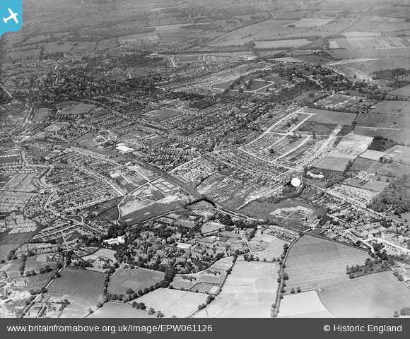
EPW061126 ENGLAND (1939). Hill End Mental Hospital and the city, St Albans, from the south-east, 1939
© Copyright OpenStreetMap contributors and licensed by the OpenStreetMap Foundation. 2026. Cartography is licensed as CC BY-SA.
Details
| Title | [EPW061126] Hill End Mental Hospital and the city, St Albans, from the south-east, 1939 |
| Reference | EPW061126 |
| Date | 30-May-1939 |
| Link | |
| Place name | ST ALBANS |
| Parish | |
| District | |
| Country | ENGLAND |
| Easting / Northing | 517364, 207025 |
| Longitude / Latitude | -0.29967879891884, 51.749156639433 |
| National Grid Reference | TL174070 |
Pins

Bex |
Friday 14th of March 2025 08:22:07 PM | |
|
Bex |
Friday 14th of March 2025 06:57:36 PM | |
|
Alban |
Saturday 20th of April 2019 04:10:49 PM | |
|
Alban |
Saturday 20th of April 2019 04:09:46 PM | |
|
Alban |
Saturday 20th of April 2019 04:08:22 PM | |
 |
Bluid |
Monday 16th of April 2018 02:57:46 PM |
|
Bluid |
Wednesday 11th of April 2018 09:27:55 AM | |
This site is great resource for the area: http://www.stalbansowneastend.co.uk/ |
Bluid |
Thursday 12th of April 2018 01:09:33 PM |
|
Bluid |
Wednesday 11th of April 2018 09:23:22 AM | |
 |
Bluid |
Wednesday 11th of April 2018 09:16:04 AM |
Ernie Cooper's dahlia smallholding, where Longacres Park is now. A member of the National Dahlia Society he specialised in developing new varieties, such as Julie. Lingold. Jim, Redun, Buttercup and Jess; all Jescot dahlias, named after his wife Jessie. The plants were grown by the tens of thousands, and Ernie was frequently searching for new ground, using land at Smallford Farm and at the new showgrounds then being developed by Roger Aylett in the mid 50s |
Bluid |
Thursday 12th of April 2018 12:41:53 PM |
 |
Bluid |
Wednesday 11th of April 2018 09:13:12 AM |
 |
Bluid |
Wednesday 11th of April 2018 09:08:28 AM |
|
John W |
Tuesday 2nd of August 2016 05:06:14 PM | |
|
John W |
Tuesday 2nd of August 2016 05:03:33 PM | |
|
John W |
Tuesday 2nd of August 2016 05:02:50 PM | |
|
FrankB |
Friday 1st of August 2014 06:51:31 PM | |
|
Mike Richardson |
Saturday 1st of March 2014 05:44:47 PM | |
|
Mike Richardson |
Saturday 1st of March 2014 05:42:57 PM | |
|
Mike Richardson |
Saturday 1st of March 2014 05:42:15 PM | |
|
mike18 |
Saturday 18th of January 2014 05:37:24 PM | |
|
mike18 |
Saturday 18th of January 2014 05:35:52 PM |