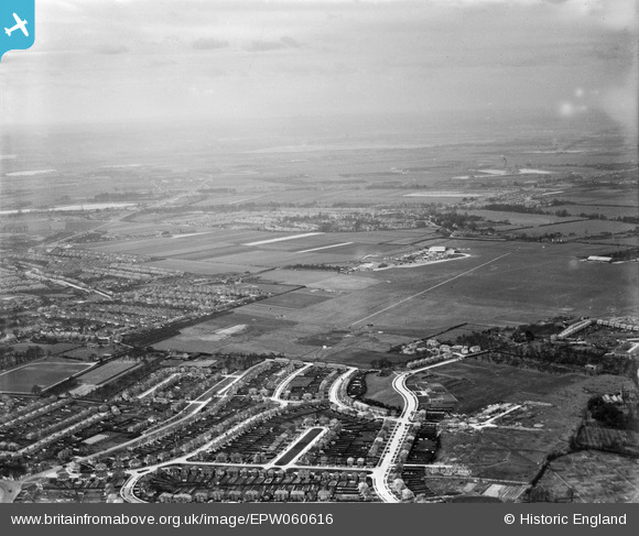
EPW060616 ENGLAND (1939). Thorncliffe Road, Heston Airport and environs, Heston, from the north-east, 1939
© Copyright OpenStreetMap contributors and licensed by the OpenStreetMap Foundation. 2024. Cartography is licensed as CC BY-SA.
Details
| Title | [EPW060616] Thorncliffe Road, Heston Airport and environs, Heston, from the north-east, 1939 |
| Reference | EPW060616 |
| Date | 2-March-1939 |
| Link | |
| Place name | HESTON |
| Parish | |
| District | |
| Country | ENGLAND |
| Easting / Northing | 512423, 178024 |
| Longitude / Latitude | -0.38053815411687, 51.489488665635 |
| National Grid Reference | TQ124780 |
Pins
 Pilot |
Tuesday 1st of December 2020 12:12:18 PM | |
 scrapemedic |
Monday 20th of January 2014 08:45:57 PM | |
 Pilot |
Wednesday 23rd of October 2013 07:06:50 PM | |
 Pilot |
Wednesday 23rd of October 2013 07:05:22 PM | |
This pin is misplaced, it should be to the left of the Norwood Green School pin |
 scrapemedic |
Monday 20th of January 2014 08:38:55 PM |
Yes this pin is in the correct position, it is the OLD North Star pub - it's replacement was built at the junction of North Hyde Lane and Thorncliffe Road, which is now sadly a shop. |
 Isleworth1961 |
Friday 16th of February 2018 12:18:09 AM |
 Pilot |
Wednesday 23rd of October 2013 07:04:08 PM | |
 Pilot |
Wednesday 23rd of October 2013 07:02:42 PM |

