
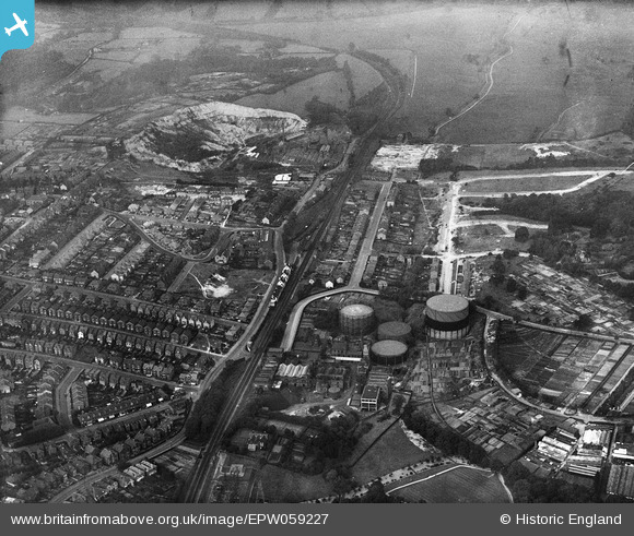
EPW059227 ENGLAND (1938). The gas works on Sandhurst Road and environs, Royal Tunbridge Wells, 1938
© Copyright OpenStreetMap contributors and licensed by the OpenStreetMap Foundation. 2026. Cartography is licensed as CC BY-SA.
Details
| Title | [EPW059227] The gas works on Sandhurst Road and environs, Royal Tunbridge Wells, 1938 |
| Reference | EPW059227 |
| Date | 11-September-1938 |
| Link | |
| Place name | ROYAL TUNBRIDGE WELLS |
| Parish | |
| District | |
| Country | ENGLAND |
| Easting / Northing | 559396, 141350 |
| Longitude / Latitude | 0.27921818234914, 51.148660198592 |
| National Grid Reference | TQ594414 |
Pins
 Silverdale Road Silverdale Road |

VCF |
Thursday 13th of August 2026 04:22:53 PM |