
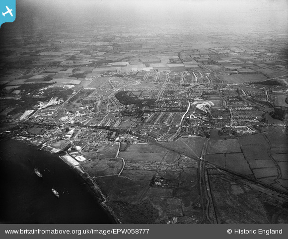
EPW058777 ENGLAND (1938). The town and environs, Grays, from the south, 1938
© Copyright OpenStreetMap contributors and licensed by the OpenStreetMap Foundation. 2026. Cartography is licensed as CC BY-SA.
Details
| Title | [EPW058777] The town and environs, Grays, from the south, 1938 |
| Reference | EPW058777 |
| Date | 24-August-1938 |
| Link | |
| Place name | GRAYS |
| Parish | |
| District | |
| Country | ENGLAND |
| Easting / Northing | 562181, 177080 |
| Longitude / Latitude | 0.33525398552808, 51.468925280992 |
| National Grid Reference | TQ622771 |
Pins

Stephen Mirrington |
Tuesday 23rd of September 2025 05:31:25 PM | |
|
MS |
Thursday 28th of March 2024 09:52:50 PM | |
|
MS |
Thursday 28th of March 2024 09:50:10 PM |