
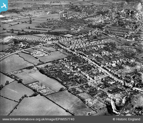
EPW057740 ENGLAND (1938). The residential area surrounding Knight Thorpe Road, Loughborough, 1938. This image has been produced from a damaged negative.
© Copyright OpenStreetMap contributors and licensed by the OpenStreetMap Foundation. 2026. Cartography is licensed as CC BY-SA.
Details
| Title | [EPW057740] The residential area surrounding Knight Thorpe Road, Loughborough, 1938. This image has been produced from a damaged negative. |
| Reference | EPW057740 |
| Date | 21-June-1938 |
| Link | |
| Place name | LOUGHBOROUGH |
| Parish | |
| District | |
| Country | ENGLAND |
| Easting / Northing | 452416, 320363 |
| Longitude / Latitude | -1.2228575225601, 52.777969716044 |
| National Grid Reference | SK524204 |
Pins

Penzo |
Sunday 12th of April 2015 11:45:52 PM | |

bescotbeast |
Sunday 9th of November 2014 02:13:07 AM |