
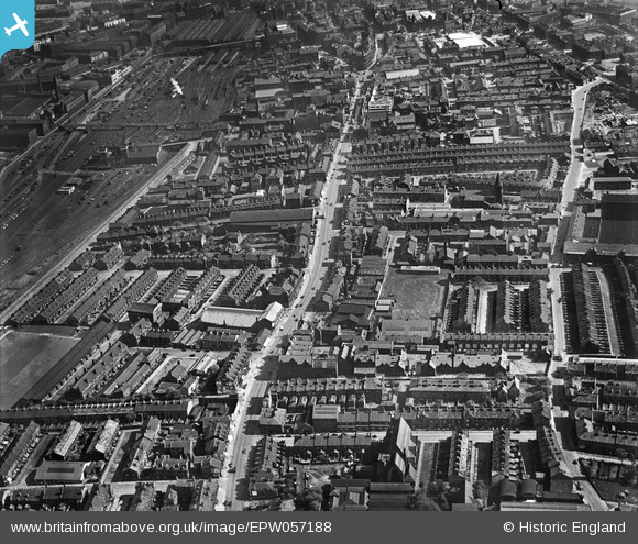
EPW057188 ENGLAND (1938). The residential area surrounding Manningham Lane and Lumb Lane, Manningham, 1938
© Copyright OpenStreetMap contributors and licensed by the OpenStreetMap Foundation. 2026. Cartography is licensed as CC BY-SA.
Details
| Title | [EPW057188] The residential area surrounding Manningham Lane and Lumb Lane, Manningham, 1938 |
| Reference | EPW057188 |
| Date | 24-May-1938 |
| Link | |
| Place name | MANNINGHAM |
| Parish | |
| District | |
| Country | ENGLAND |
| Easting / Northing | 415846, 434004 |
| Longitude / Latitude | -1.759376733963, 53.801880612916 |
| National Grid Reference | SE158340 |
Pins

Dave T |
Thursday 25th of March 2021 01:34:15 PM | |
|
carol |
Friday 10th of April 2020 09:08:38 PM | |
|
carol |
Friday 10th of April 2020 09:07:30 PM | |
|
Lizzy |
Tuesday 25th of February 2020 12:58:12 PM | |
|
nazman |
Sunday 22nd of January 2017 07:36:18 PM | |
|
danimo77 |
Tuesday 25th of February 2014 11:32:31 PM | |
|
H.J.Hill |
Thursday 28th of November 2013 10:05:50 AM |