
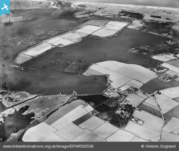
EPW056538 ENGLAND (1938). Flooded countryside, Somerton Holmes, 1938
© Copyright OpenStreetMap contributors and licensed by the OpenStreetMap Foundation. 2025. Cartography is licensed as CC BY-SA.
Details
| Title | [EPW056538] Flooded countryside, Somerton Holmes, 1938 |
| Reference | EPW056538 |
| Date | 12-March-1938 |
| Link | |
| Place name | SOMERTON HOLMES |
| Parish | SOMERTON |
| District | |
| Country | ENGLAND |
| Easting / Northing | 646887, 320468 |
| Longitude / Latitude | 1.6566533740834, 52.725063190928 |
| National Grid Reference | TG469205 |
Pins
Be the first to add a comment to this image!