
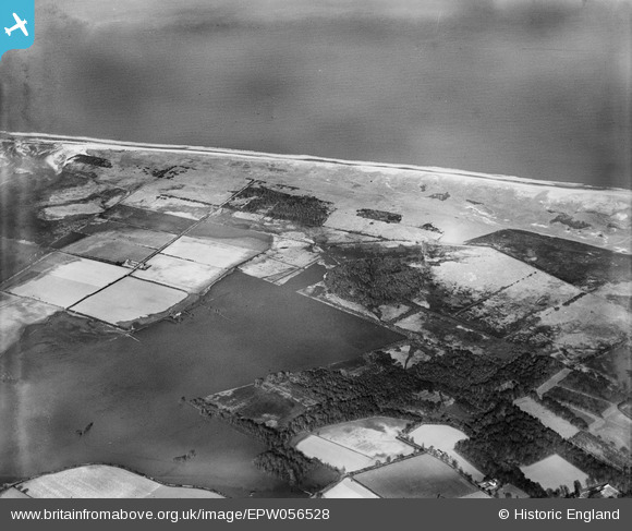
EPW056528 ENGLAND (1938). Flooding to the west of Decoy Wood, Winterton Holmes, 1938
© Copyright OpenStreetMap contributors and licensed by the OpenStreetMap Foundation. 2025. Cartography is licensed as CC BY-SA.
Details
| Title | [EPW056528] Flooding to the west of Decoy Wood, Winterton Holmes, 1938 |
| Reference | EPW056528 |
| Date | 12-March-1938 |
| Link | |
| Place name | WINTERTON HOLMES |
| Parish | WINTERTON-ON-SEA |
| District | |
| Country | ENGLAND |
| Easting / Northing | 648240, 321132 |
| Longitude / Latitude | 1.6771497158646, 52.730401645753 |
| National Grid Reference | TG482211 |
Pins
Be the first to add a comment to this image!