
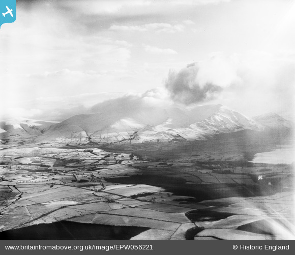
EPW056221 ENGLAND (1937). Howgill Wood, Longside Edge and the summit of Skiddaw shrouded in cloud, Isel Old Park, from the north-west, 1937
© Copyright OpenStreetMap contributors and licensed by the OpenStreetMap Foundation. 2025. Cartography is licensed as CC BY-SA.
Details
| Title | [EPW056221] Howgill Wood, Longside Edge and the summit of Skiddaw shrouded in cloud, Isel Old Park, from the north-west, 1937 |
| Reference | EPW056221 |
| Date | 6-December-1937 |
| Link | |
| Place name | ISEL OLD PARK |
| Parish | BLINDCRAKE |
| District | |
| Country | ENGLAND |
| Easting / Northing | 319579, 534133 |
| Longitude / Latitude | -3.2479237744681, 54.695690538609 |
| National Grid Reference | NY196341 |
Pins

Duncanross |
Saturday 27th of April 2019 03:03:55 PM | |
|
Duncanross |
Saturday 27th of April 2019 02:55:58 PM |