
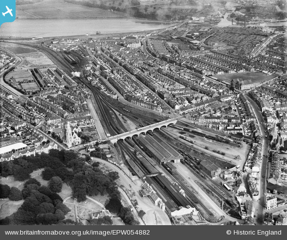
EPW054882 ENGLAND (1937). Friary Railway Station and St Jude's, Plymouth, 1937
© Copyright OpenStreetMap contributors and licensed by the OpenStreetMap Foundation. 2026. Cartography is licensed as CC BY-SA.
Details
| Title | [EPW054882] Friary Railway Station and St Jude's, Plymouth, 1937 |
| Reference | EPW054882 |
| Date | 16-August-1937 |
| Link | |
| Place name | PLYMOUTH |
| Parish | |
| District | |
| Country | ENGLAND |
| Easting / Northing | 248934, 54593 |
| Longitude / Latitude | -4.1245804668562, 50.371204011857 |
| National Grid Reference | SX489546 |
Pins

forostar |
Friday 2nd of December 2022 04:29:59 PM | |
|
W11120 |
Tuesday 4th of August 2020 06:03:21 PM | |
|
gBr |
Sunday 23rd of April 2017 07:49:17 PM | |
|
gBr |
Sunday 23rd of April 2017 07:40:35 PM | |
|
TinRobotToy |
Wednesday 16th of March 2016 11:46:43 AM | |
|
TinRobotToy |
Wednesday 16th of March 2016 11:45:19 AM | |
|
TinRobotToy |
Wednesday 16th of March 2016 11:43:54 AM | |
|
GrahamNaylor |
Sunday 28th of September 2014 03:29:20 PM | |
|
GrahamNaylor |
Sunday 28th of September 2014 03:28:38 PM | |
|
GrahamNaylor |
Sunday 28th of September 2014 03:28:22 PM |