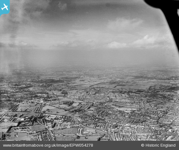
EPW054278 ENGLAND (1937). An infrared photograph over Benhilton and Carshalton, Sutton, from the west, 1937
© Copyright OpenStreetMap contributors and licensed by the OpenStreetMap Foundation. 2026. Cartography is licensed as CC BY-SA.
Details
| Title | [EPW054278] An infrared photograph over Benhilton and Carshalton, Sutton, from the west, 1937 |
| Reference | EPW054278 |
| Date | 13-July-1937 |
| Link | |
| Place name | SUTTON |
| Parish | |
| District | |
| Country | ENGLAND |
| Easting / Northing | 525524, 165199 |
| Longitude / Latitude | -0.19645854736472, 51.371458770016 |
| National Grid Reference | TQ255652 |
Pins

christhewino |
Sunday 2nd of November 2014 01:00:21 PM | |

bingram1970 |
Tuesday 7th of October 2014 08:07:09 PM | |

christhewino |
Sunday 28th of July 2013 11:03:53 AM | |

christhewino |
Sunday 28th of July 2013 11:02:55 AM | |

christhewino |
Sunday 28th of July 2013 11:01:29 AM | |

christhewino |
Sunday 28th of July 2013 11:01:06 AM | |

christhewino |
Sunday 28th of July 2013 10:59:56 AM | |

christhewino |
Sunday 28th of July 2013 10:59:36 AM | |

christhewino |
Sunday 28th of July 2013 10:57:56 AM | |

christhewino |
Sunday 28th of July 2013 10:57:36 AM | |

christhewino |
Sunday 28th of July 2013 10:54:07 AM | |

christhewino |
Sunday 28th of July 2013 10:53:33 AM | |

christhewino |
Sunday 28th of July 2013 10:52:52 AM |

