
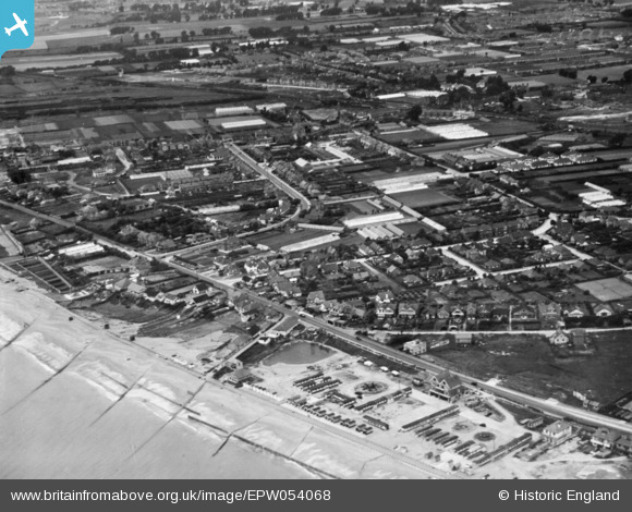
EPW054068 ENGLAND (1937). Brighton Road, Penhill Road and environs, Lancing, 1937. This image has been produced from a copy-negative.
© Copyright OpenStreetMap contributors and licensed by the OpenStreetMap Foundation. 2026. Cartography is licensed as CC BY-SA.
Details
| Title | [EPW054068] Brighton Road, Penhill Road and environs, Lancing, 1937. This image has been produced from a copy-negative. |
| Reference | EPW054068 |
| Date | June-1937 |
| Link | |
| Place name | LANCING |
| Parish | LANCING |
| District | |
| Country | ENGLAND |
| Easting / Northing | 518700, 103978 |
| Longitude / Latitude | -0.31459190060332, 50.822599695693 |
| National Grid Reference | TQ187040 |
Pins

ALAN S |
Wednesday 10th of February 2016 07:59:24 PM |