
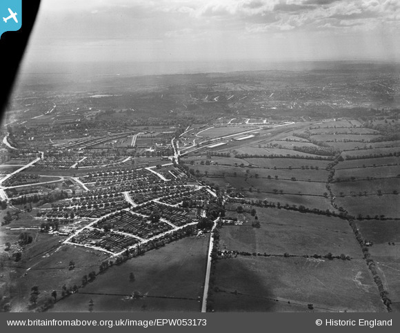
EPW053173 ENGLAND (1937). Bramley Road, Oakwood and environs, Enfield, from the north-east, 1937
© Copyright OpenStreetMap contributors and licensed by the OpenStreetMap Foundation. 2026. Cartography is licensed as CC BY-SA.
Details
| Title | [EPW053173] Bramley Road, Oakwood and environs, Enfield, from the north-east, 1937 |
| Reference | EPW053173 |
| Date | 21-May-1937 |
| Link | |
| Place name | ENFIELD |
| Parish | |
| District | |
| Country | ENGLAND |
| Easting / Northing | 530066, 196477 |
| Longitude / Latitude | -0.11969406087055, 51.651552825688 |
| National Grid Reference | TQ301965 |
Pins

Macmartyn |
Monday 4th of November 2013 03:29:22 PM | |
|
Macmartyn |
Monday 4th of November 2013 03:27:48 PM | |
|
Macmartyn |
Monday 4th of November 2013 03:25:38 PM | |
|
Macmartyn |
Monday 4th of November 2013 03:22:13 PM | |
|
Macmartyn |
Monday 4th of November 2013 03:11:35 PM | |
|
Macmartyn |
Monday 4th of November 2013 03:09:14 PM | |
|
Macmartyn |
Monday 4th of November 2013 03:08:30 PM | |
|
Macmartyn |
Monday 4th of November 2013 03:07:58 PM | |
|
Macmartyn |
Monday 4th of November 2013 03:06:01 PM | |
|
Macmartyn |
Monday 4th of November 2013 03:04:36 PM | |
|
Macmartyn |
Monday 4th of November 2013 03:02:26 PM |