
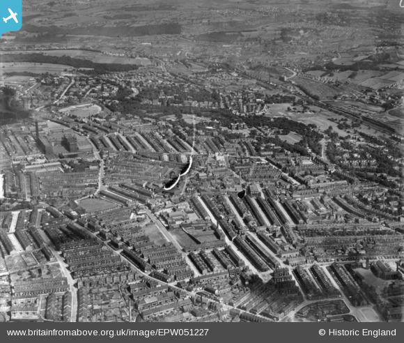
EPW051227 ENGLAND (1936). A cityscape over Manningham, Bradford, from the south, 1936. This image has been produced from a damaged print.
© Copyright OpenStreetMap contributors and licensed by the OpenStreetMap Foundation. 2026. Cartography is licensed as CC BY-SA.
Details
| Title | [EPW051227] A cityscape over Manningham, Bradford, from the south, 1936. This image has been produced from a damaged print. |
| Reference | EPW051227 |
| Date | July-1936 |
| Link | |
| Place name | BRADFORD |
| Parish | |
| District | |
| Country | ENGLAND |
| Easting / Northing | 415123, 434224 |
| Longitude / Latitude | -1.7703446637284, 53.803879701333 |
| National Grid Reference | SE151342 |
Pins

david |
Friday 5th of January 2024 04:59:19 AM | |
|
david |
Friday 5th of January 2024 04:56:56 AM | |
|
david |
Friday 5th of January 2024 04:54:10 AM | |
|
Dave T |
Thursday 25th of March 2021 01:53:32 PM | |
|
Dave T |
Thursday 25th of March 2021 01:51:06 PM | |
|
Dave T |
Thursday 25th of March 2021 01:50:22 PM | |
|
Dave T |
Thursday 25th of March 2021 01:48:40 PM | |
|
david |
Thursday 21st of January 2016 01:03:49 AM |
