
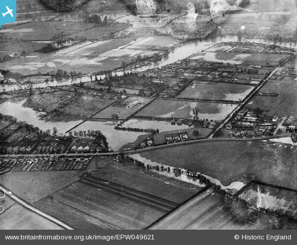
EPW049621 ENGLAND (1936). Flooding around Sweep's Ditch and the River Thames, Laleham, 1936. This image has been produced from a damaged negative.
© Copyright OpenStreetMap contributors and licensed by the OpenStreetMap Foundation. 2026. Cartography is licensed as CC BY-SA.
Details
| Title | [EPW049621] Flooding around Sweep's Ditch and the River Thames, Laleham, 1936. This image has been produced from a damaged negative. |
| Reference | EPW049621 |
| Date | January-1936 |
| Link | |
| Place name | LALEHAM |
| Parish | |
| District | |
| Country | ENGLAND |
| Easting / Northing | 504296, 170018 |
| Longitude / Latitude | -0.499924509897, 51.41907663296 |
| National Grid Reference | TQ043700 |
Pins
Be the first to add a comment to this image!