
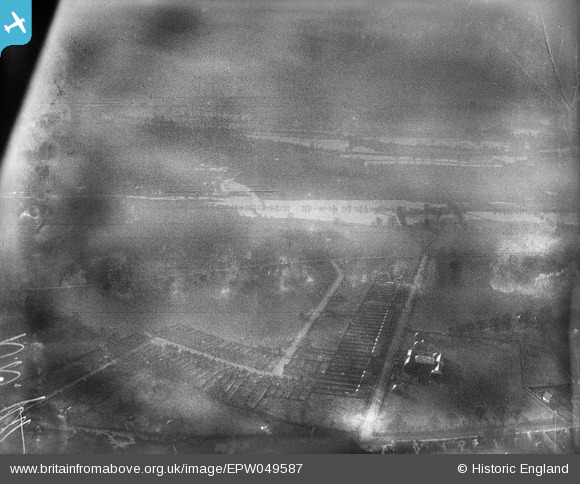
EPW049587 ENGLAND (1936). Flooding at Upton, Slough, 1936
© Copyright OpenStreetMap contributors and licensed by the OpenStreetMap Foundation. 2026. Cartography is licensed as CC BY-SA.
Details
| Title | [EPW049587] Flooding at Upton, Slough, 1936 |
| Reference | EPW049587 |
| Date | January-1936 |
| Link | |
| Place name | SLOUGH |
| Parish | |
| District | |
| Country | ENGLAND |
| Easting / Northing | 498690, 178753 |
| Longitude / Latitude | -0.57808907860258, 51.498606513725 |
| National Grid Reference | SU987788 |
Pins

Class31 |
Tuesday 28th of May 2013 09:34:38 AM | |
|
Class31 |
Tuesday 28th of May 2013 09:31:35 AM | |
|
Class31 |
Tuesday 28th of May 2013 09:30:41 AM | |
|
Class31 |
Tuesday 28th of May 2013 09:29:44 AM | |
|
Class31 |
Tuesday 28th of May 2013 09:27:39 AM | |
|
Class31 |
Tuesday 28th of May 2013 09:26:02 AM | |
|
Class31 |
Tuesday 28th of May 2013 09:25:00 AM | |
|
Class31 |
Tuesday 28th of May 2013 09:23:27 AM | |
|
Class31 |
Tuesday 28th of May 2013 09:22:13 AM |
User Comment Contributions
Eureka Well this one had to be found to complete the block of Thames flooding photos.The view is looking southwest from Slough towards Windsor Castle but I can't make out any recognisible features of Windsor Castle through the gloom. Everything fits for the location given. I have only annotated the near features which I can identify. |
Class31 |
Friday 7th of June 2013 02:16:09 PM |
Well spotted Class31. |
Hefin Meara |
Friday 7th of June 2013 02:16:09 PM |