
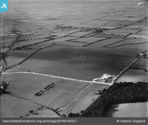
EPW049217 ENGLAND (1935). Newcastle Airport, Woolsington, from the south-east, 1935
© Copyright OpenStreetMap contributors and licensed by the OpenStreetMap Foundation. 2026. Cartography is licensed as CC BY-SA.
Details
| Title | [EPW049217] Newcastle Airport, Woolsington, from the south-east, 1935 |
| Reference | EPW049217 |
| Date | September-1935 |
| Link | |
| Place name | WOOLSINGTON |
| Parish | WOOLSINGTON |
| District | |
| Country | ENGLAND |
| Easting / Northing | 419397, 570826 |
| Longitude / Latitude | -1.6965050685281, 55.031511690664 |
| National Grid Reference | NZ194708 |
