
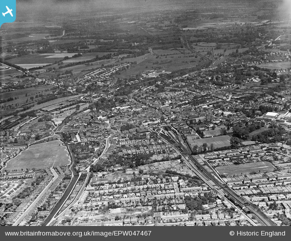
EPW047467 ENGLAND (1935). The town, Uxbridge, from the south, 1935
© Copyright OpenStreetMap contributors and licensed by the OpenStreetMap Foundation. 2026. Cartography is licensed as CC BY-SA.
Details
| Title | [EPW047467] The town, Uxbridge, from the south, 1935 |
| Reference | EPW047467 |
| Date | May-1935 |
| Link | |
| Place name | UXBRIDGE |
| Parish | |
| District | |
| Country | ENGLAND |
| Easting / Northing | 505529, 183557 |
| Longitude / Latitude | -0.47815096280798, 51.540555488106 |
| National Grid Reference | TQ055836 |
Pins

M |
Tuesday 24th of September 2024 12:37:53 AM | |
|
Neil Desperandum |
Thursday 29th of December 2022 11:17:20 AM | |
|
Andy Delahunty |
Saturday 2nd of January 2021 12:12:39 PM | |
|
moses72 |
Thursday 17th of October 2013 11:54:46 AM | |
|
moses72 |
Thursday 17th of October 2013 11:48:47 AM | |
|
moses72 |
Thursday 17th of October 2013 11:47:36 AM | |
|
dave43 |
Tuesday 14th of May 2013 09:30:06 PM | |
|
dave43 |
Tuesday 14th of May 2013 09:29:37 PM | |
|
dave43 |
Tuesday 14th of May 2013 09:29:09 PM | |
|
dave43 |
Tuesday 14th of May 2013 09:28:18 PM |
User Comment Contributions
Seeing that this photo claims to have been taken just 18 months before the opening of the new Underground terminus in the High Street (Dec 4th 1936)there is amazingly little sign of any associated construction work, or even preparatory demolition. |
moses72 |
Tuesday 11th of March 2014 12:13:38 PM |