
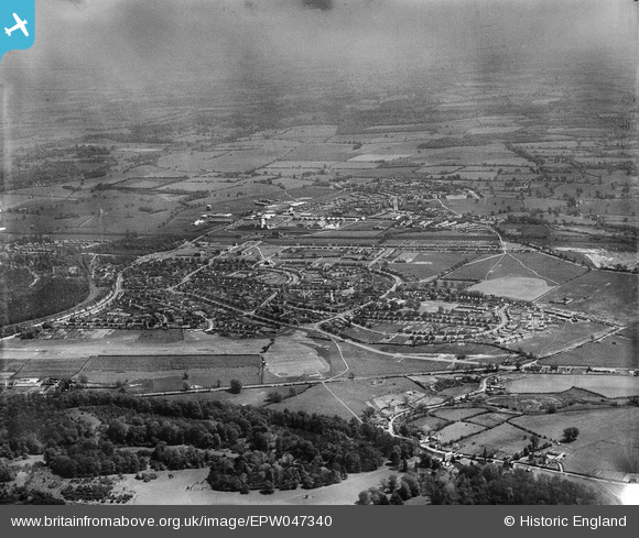
EPW047340 ENGLAND (1935). The town, Welwyn Garden City, from the north-west, 1935
© Copyright OpenStreetMap contributors and licensed by the OpenStreetMap Foundation. 2025. Cartography is licensed as CC BY-SA.
Details
| Title | [EPW047340] The town, Welwyn Garden City, from the north-west, 1935 |
| Reference | EPW047340 |
| Date | May-1935 |
| Link | |
| Place name | WELWYN GARDEN CITY |
| Parish | HATFIELD |
| District | |
| Country | ENGLAND |
| Easting / Northing | 522269, 212637 |
| Longitude / Latitude | -0.2266766963233, 51.798546871741 |
| National Grid Reference | TL223126 |
Pins

Chells809 |
Monday 17th of June 2013 10:34:30 PM | |
|
Chells809 |
Monday 17th of June 2013 10:33:02 PM | |
The line was built through to Dunstable, where it joined end-on to a L&NWR branch from Leighton Buzzard. The L&NWR branch, then part of the London Midland region of BR, closed in 1966, other than a short length at Leighton Buzzard. The line from Dunstable to Hatfield lost its passenger service in April 1965. Sections remained open between Luton and Dunstable and between Hatfield and Blackbridge Sidings (between Ayot and Wheathampstead) for goods traffic. The latter traffic stopped in 1971 and the line was dismantled. |
John W |
Thursday 23rd of June 2016 07:42:53 PM |
|
Chells809 |
Monday 17th of June 2013 10:29:25 PM | |
|
Chells809 |
Monday 17th of June 2013 10:25:34 PM | |
|
Chells809 |
Monday 17th of June 2013 10:23:28 PM | |
|
Chells809 |
Monday 17th of June 2013 10:21:16 PM | |
|
Chells809 |
Monday 17th of June 2013 10:19:51 PM | |
|
Chells809 |
Monday 17th of June 2013 10:18:04 PM | |
|
Chells809 |
Monday 17th of June 2013 10:16:47 PM | |
|
Chells809 |
Monday 17th of June 2013 10:14:28 PM | |
|
Chells809 |
Monday 17th of June 2013 10:12:41 PM |
User Comment Contributions
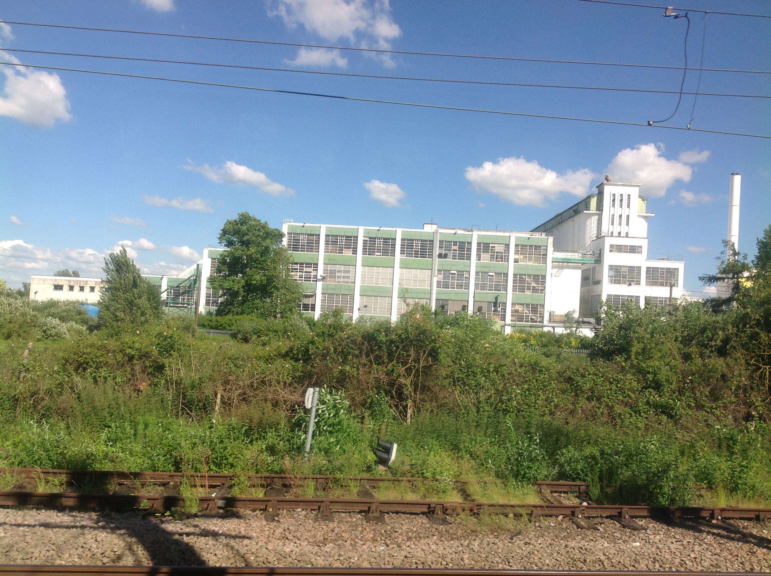
The Shredded Wheat Factory from a train, Welwyn Garden City, 10/06/2014 |

Class31 |
Wednesday 11th of June 2014 04:50:21 PM |