
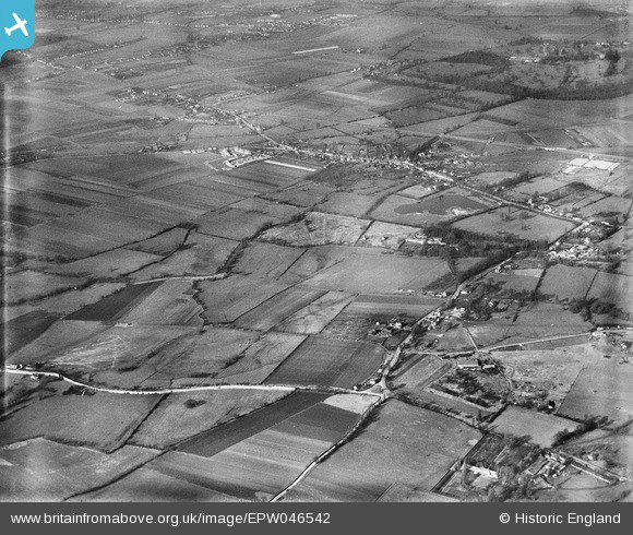
EPW046542 ENGLAND (1935). Land between the villages of Poyle and Colnbrook, Poyle, 1935
© Copyright OpenStreetMap contributors and licensed by the OpenStreetMap Foundation. 2026. Cartography is licensed as CC BY-SA.
Details
| Title | [EPW046542] Land between the villages of Poyle and Colnbrook, Poyle, 1935 |
| Reference | EPW046542 |
| Date | February-1935 |
| Link | |
| Place name | POYLE |
| Parish | COLNBROOK WITH POYLE |
| District | |
| Country | ENGLAND |
| Easting / Northing | 502708, 176360 |
| Longitude / Latitude | -0.52091501880023, 51.476378636646 |
| National Grid Reference | TQ027764 |
Pins

Brian |
Thursday 27th of January 2022 05:33:33 PM | |
|
Tony Sargeant |
Saturday 11th of January 2020 05:52:45 PM | |
|
dave43 |
Friday 17th of November 2017 09:08:38 PM | |
|
Johnners |
Tuesday 4th of June 2013 12:10:38 PM | |
and the Punch Bowl? it's been 50 years! |
dave43 |
Monday 10th of June 2013 07:55:48 PM |
|
Johnners |
Tuesday 4th of June 2013 12:09:13 PM | |
|
dave43 |
Wednesday 15th of May 2013 07:58:59 PM | |
|
dave43 |
Wednesday 15th of May 2013 07:58:16 PM | |
|
dave43 |
Wednesday 15th of May 2013 07:57:20 PM | |
Yes, The High Street |
Johnners |
Tuesday 4th of June 2013 12:07:10 PM |
User Comment Contributions

The Star & Garter PH, Park Street, Colnbrook. Photograph taken yesterday. |

Class31 |
Wednesday 17th of July 2013 09:06:08 AM |
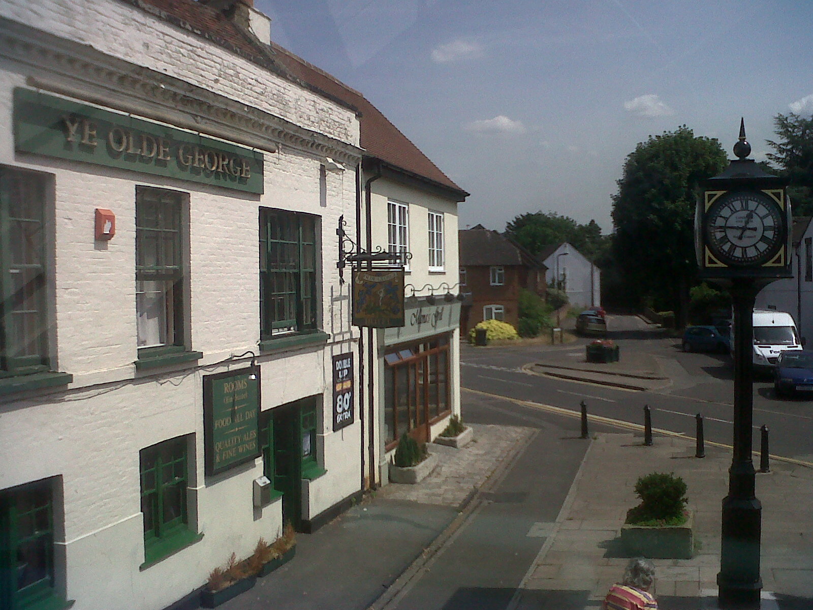
Ye Olde George PH, Colnbrook and new clock not on Google Maps. Photograph taken yesterday. |
Class31 |
Wednesday 17th of July 2013 08:57:34 AM |

The Ostrich Inn, Colnbrook looking east, claimed to be the third oldest inn in England. Photograph taken yesterday. |
Class31 |
Wednesday 17th of July 2013 08:52:48 AM |